The Madrid metro, officially known as “Metro de Madrid”, It is the underground transportation system of the capital of Spain. Inaugurated on 17 October 1919, has experienced great growth throughout its history, with its last extension carried out in 2022.
The network consists of 13 lines that add up to a total of 302 stations, covering 324 kilometres (about 201,32 miles).
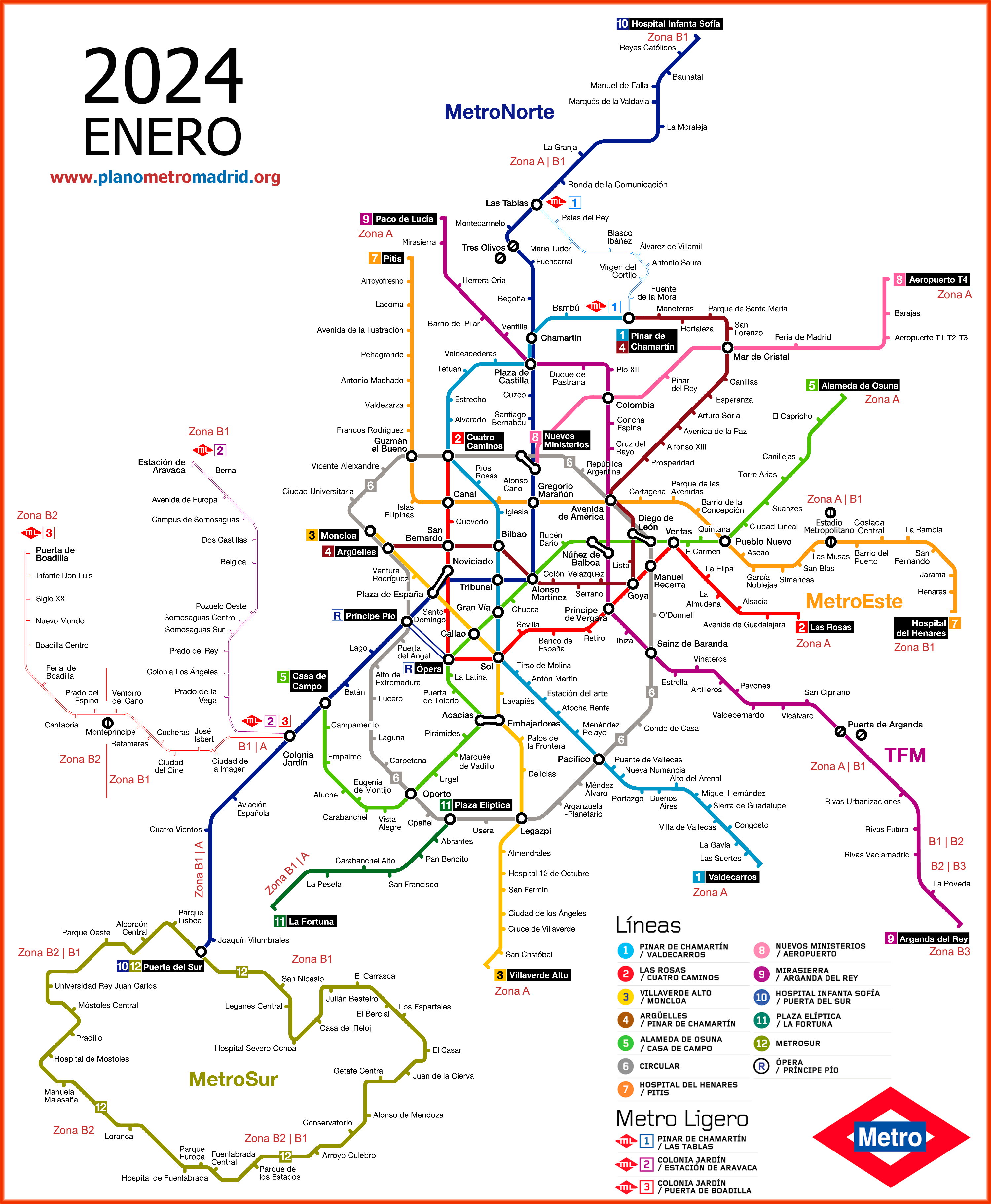
subway map
This is the Madrid metro map, click on the image to see it larger:
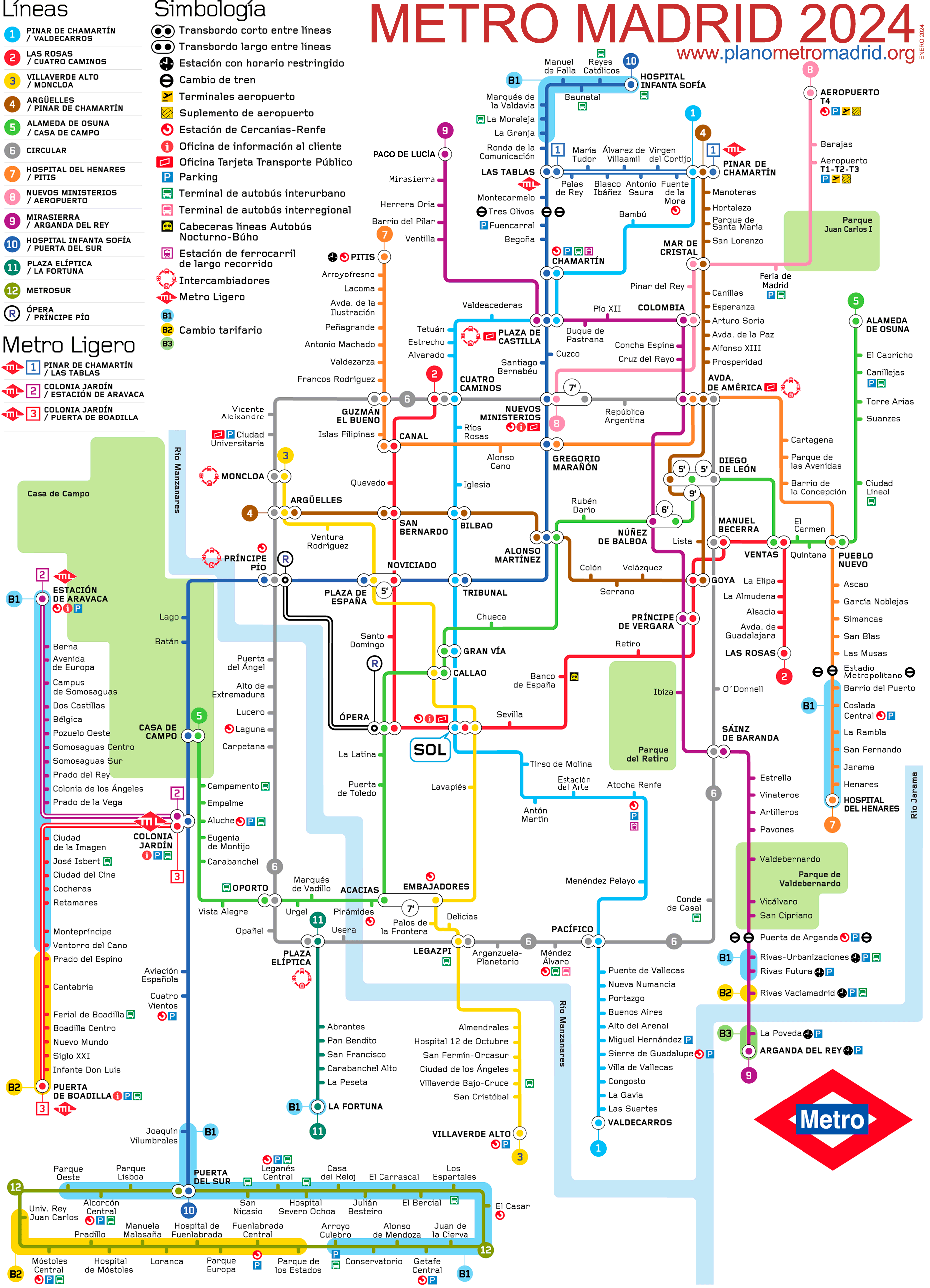
This is the same map of the Madrid metro but with a more schematic design:
RECOMMENDATION: On the web Tiqets, You can save up to 20% in some bills as in the Touristic bus, Reina Sofia Museum, Taxi Airport Hotel, or purchase tickets for museums, attractions, monuments, and other things that will surprise you. Generally if you buy these tickets online, you save queuing and money.
Official Web site
- Unofficial website of the Madrid metro (Easier to use).
- Official website of the Madrid metro.
- List of all tourist attractions in Madrid (in multiple languages, with unpublished things).
Madrid metro schedules
The Madrid metro schedule is always the same, both on weekdays and holidays:
- Opening hours: at 6:05 in the morning.
- Closing time: at 2:00 am.
However, It must be taken into account that the trains make their last journey from the terminal stations to the 1:33, so the last train of each day can pass through the station at any time, between the 1:33 and the 2:00, depending on where you are in the line.
Madrid metro fares 2024
The Madrid metro offers a variety of ticket and pass options. Next, A table is presented with the main prices in euros (and its equivalent in US dollars to give tourists a better idea of prices):
| Type of ticket | Price in EUR | Price in USD |
|---|---|---|
| One-way ticket | 1,50 – 2,00 | 1.64 – 2.19 |
| Airport Supplement | 4,50 | 4.92 |
| Ticket 10 trips | 12,20 | 13.34 |
| Tourist Card 1 day | 8,40 | 9.18 |
| Tourist Card 7 days | 35,40 | 38.69 |
In addition to these tickets, There are several cards and subscriptions that offer discounts and additional facilities:
- Tarjeta Multi: It is a rechargeable contactless card that can be used to load different types of tickets and passes. Its initial cost is 2,50 EUR (2.73 USD).
- Abono Transporte: This is a monthly pass that allows unlimited travel within selected areas. It is ideal for residents and people who use the subway frequently.
- Tarjeta Turística: Offers unlimited travel within Madrid's transportation network for a certain number of days. It is especially useful for tourists. Prices vary depending on duration, from one day to seven days.
- Discounts for Young and Old: There are reduced rates for young people under 26 years and older 65 years. There are also discounts for large families and people with disabilities..
History of the Madrid metro
It all started in 1917 when the works on the first section got underway, joined Cuatro Caminos with Puerta del Sol. This project was promoted by engineers Miguel Otamendi, Carlos Mendoza y Antonio González Echarte.
To finance this ambitious project, The engineers managed to convince the Banco de Vizcaya to contribute four million pesetas, on the condition that another four million were obtained from other sources. The Compañía Metropolitano Alfonso XIII, named after the king, was officially established 24 January 1917 with a capital of ten million pesetas.
The architect Antonio Palacios was in charge of designing the stations, metro entrances and buildings. The works began on 23 April 1917, and due to World War I, many materials had to be bought second hand, including electric motors of the Paris metro.
20s′
The Official inauguration of the first line of the Madrid metro was celebrated on 17 October 1919. Alfonso XIII was the first traveler to travel the stretch of 3.48 km that united Cuatro Caminos with the Puerta del Sol, passing through stations like Ríos Rosas, Iglesia, Chamberí, Bilbao, Tribunal y Gran Vía. This route was opened to the public on 31 October 1919 and it was an immediate success, transporting more than 14 million users in its first year.
In the years 20, The Madrid metro continued to expand. The 26 December 1921, The expansion towards Atocha was inaugurated, and in May 1923, extended until Puente de Vallecas. The second line, that connected Sol con Ventas, The 14 June 1924.
30s′ y 40′
During the Spanish Civil War (1936-1939), The Madrid metro served as a bomb shelter and its trains were used as ambulances. despite the war, the subway continued operating and, subsequently, in the decade of the 40, Major expansions and modernizations were carried out.
70's′ y 80′
In the years 70, The metro underwent a great expansion with the construction of new lines (6, 7, 8, 9 y 10). This period of growth continued in the years 80, during which the length of the network increased by a 50%, surpassing the 100 kilometers in 1983. In 1986, the subway was integrated into the Consorcio Regional de Transportes from Madrid.
XXI century
In between 2003 y 2007, The Madrid metro experienced another great expansion with the inauguration of MetroNorte, MetroOeste y Metro Ligero, which helped better connect suburban areas with the city center and transformed into the huge metro it is now.
History of the Madrid metro map
The first design of the Madrid metro map was the work of Antonio Palacios, the same architect responsible for the design of the original stations. This first map, simple and clear design, It reflected a single line and was designed only to be functional..
During the first decades, the map was kept simple due to the limited extent of the network. However, as the network grew, the map became a more complex work of design.
40s′
In the decade of 1940, the engineer Javier Bustinduy introduced a new scheme of the Madrid metro map with a simplified layout. This new design helped passengers easily identify connections and improved the user experience. Over time, This map evolved towards a more schematic and stylized design, taking as reference the style of the famous map of Harry Beck of the London subway.
70's′ y 80′
In the years 70, with the great expansion of the metro that included the construction of the lines 6, 7, 8, 9 y 10, the subway map had to be redesigned to accommodate these new lines. This period marked an important change in design, becoming more complex and detailed.
Both the Madrid metro map in the years 70, as in the years 80 was made by the designer Arcadi Moradell, especially the design he made in 1981. This design has survived in many aspects until today., influencing the signage and graphic representation of the metro that many users continue to recognize and use.
XXI century
The study RaRo S.L. began designing the plans for the Madrid metro around the year 2007, when a modernized version of the network schematic plan was introduced. This change sought to adapt the plan design to the growth of the metro network., which had spread significantly to the outskirts of the city. But it was not well received by Madrid residents due to various readability and usefulness problems.. Basically, metro users valued the geographical location of the stations more than the functionality of a very nice map but that did not respect the geographical location.. And for this reason in 2013 went back to the previous design of the map of Madrid.
From then to the present, The current design of the Madrid metro plan has been developed by the studio RaRo S.L. and continues to influence the current designs of the Madrid metro.
Additional data
The Madrid metro allows easy access to the most important sites in the city:
- Museo del Prado (Atocha; L1): Collection of European art from the 12th to the 19th centuries. Essential!
- Parque del Retiro (Retiro; L2): Green lung of Madrid. Ideal for relaxing and walking.
- Puerta del Sol (Sol; L1, L2, L3): Neural center of the city. Here you will find the famous Kilometer Zero.
- Palacio Real (Ópera; L2, R): Official residence of the Spanish royal family. Stunning gardens and architecture.
- Plaza Mayor (Sol; L1, L2, L3): Historic and picturesque. Perfect to enjoy local cuisine.
- Gran Vía (Gran Vía; L1, L5): Main commercial and leisure artery. Theaters, shops and nightlife.
- Templo de Debod (Plaza de España; L3, L10): ancient egyptian temple. Offers spectacular views at sunset.
- Estadio Santiago Bernabéu (Santiago Bernabéu; L10): Home of Real Madrid. Visit its museum and feel the emotion of football.
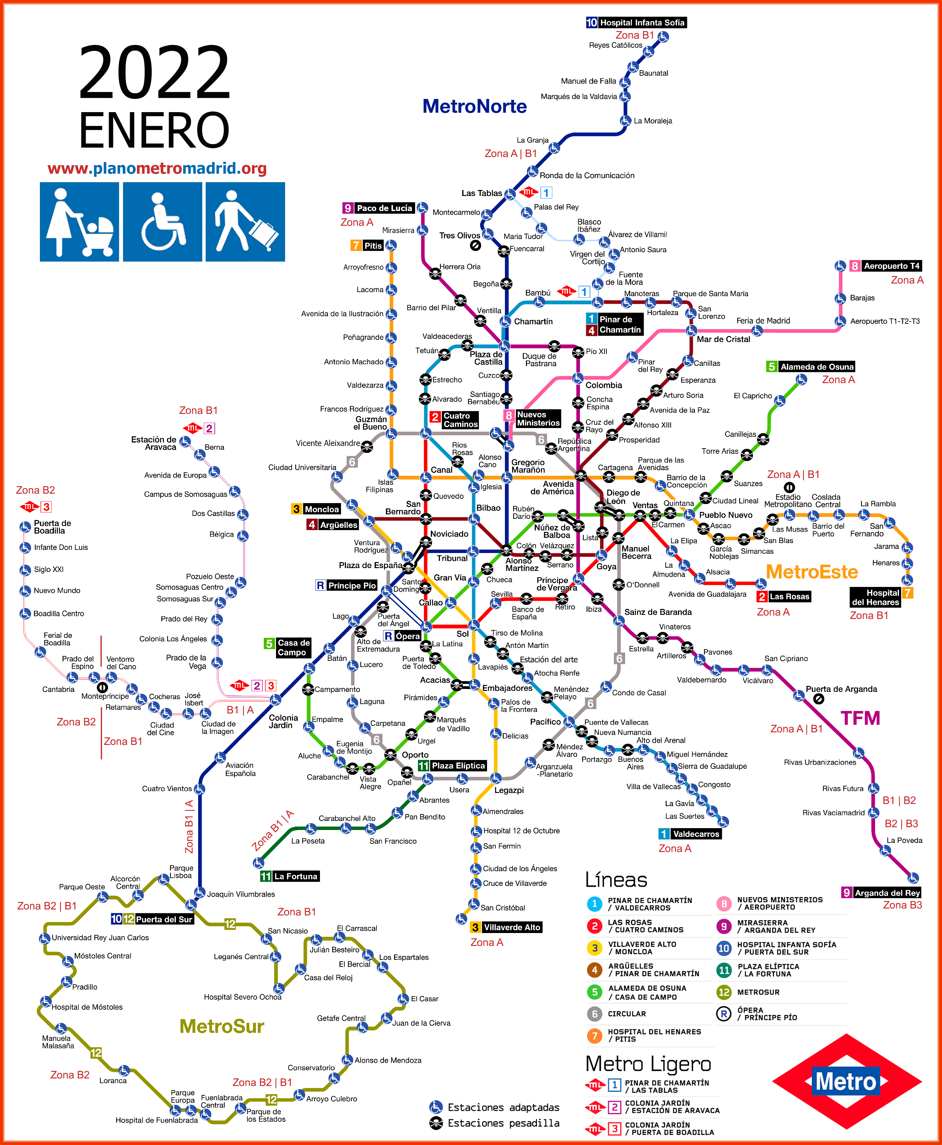
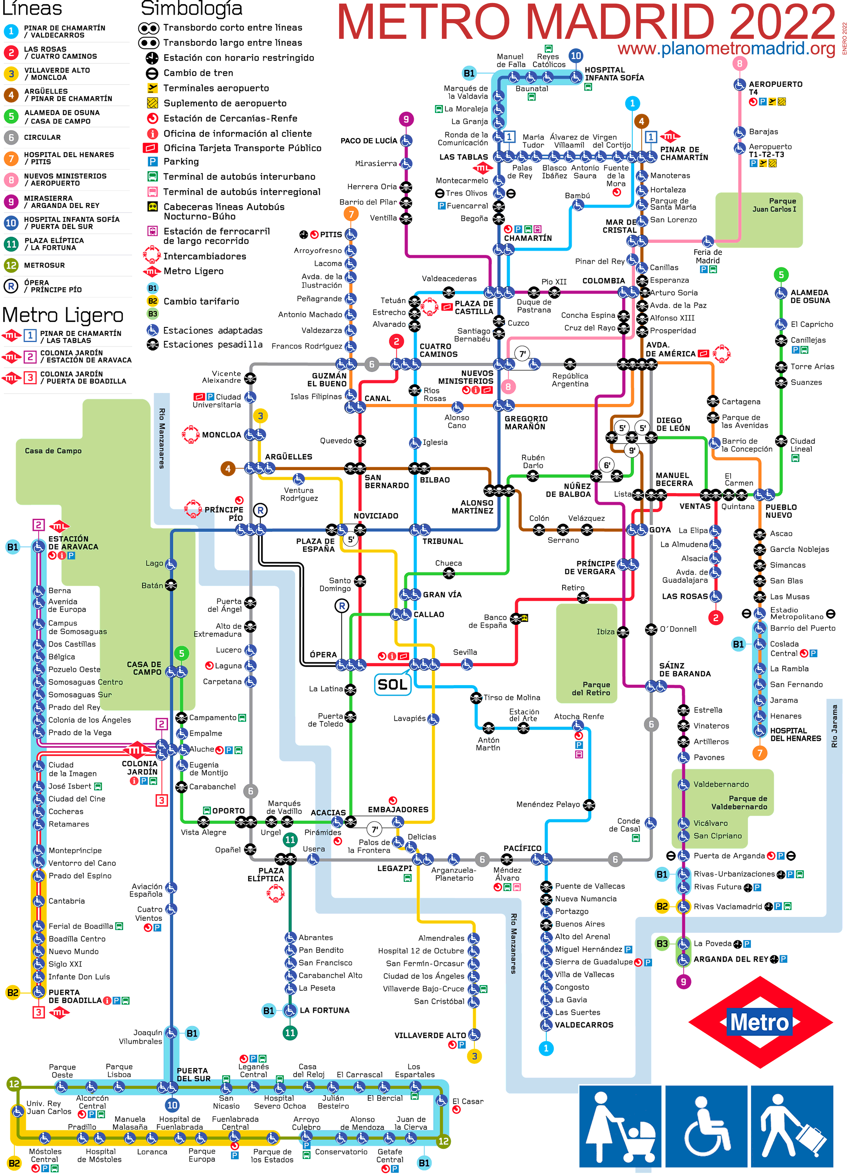
Other old Madrid metro maps:
These are old Madrid metro maps. There are more updated maps at planometromadrid.org
Maps by line, one by one
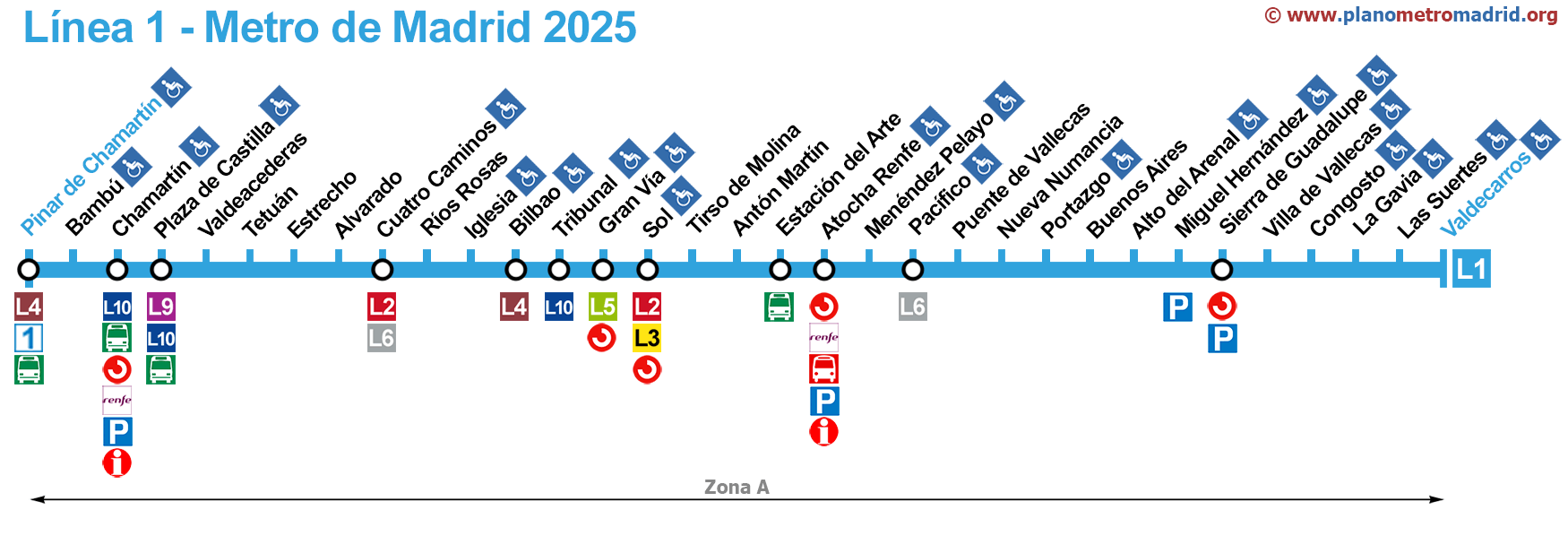
Line 1 (33 stations):
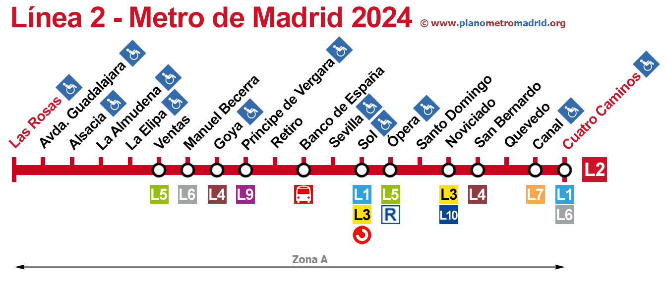
Line 2 (20 stations):
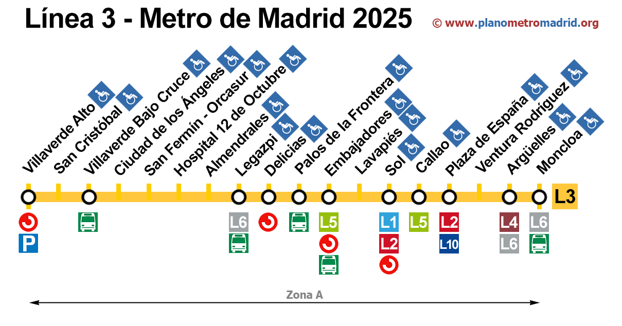
Line 3 (18 stations):
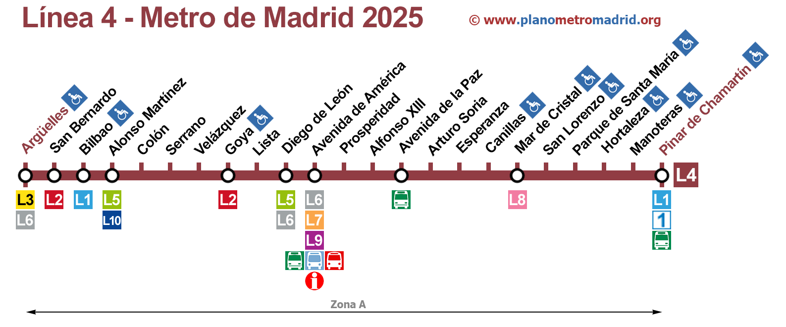
Line 4 (23 stations):
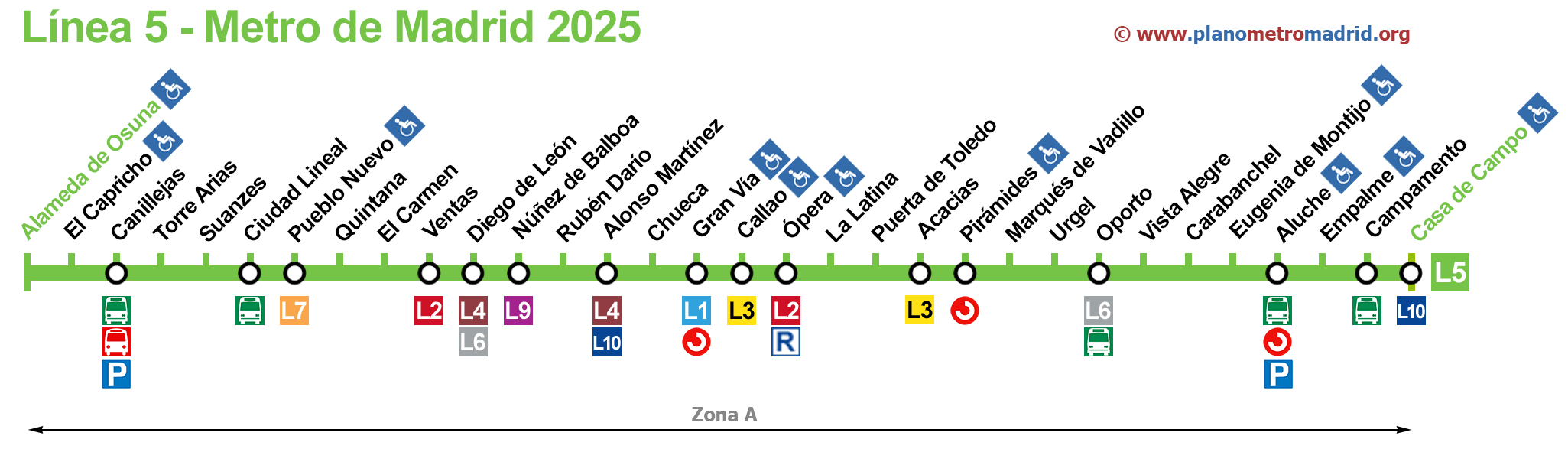
Line 5 (32 stations):
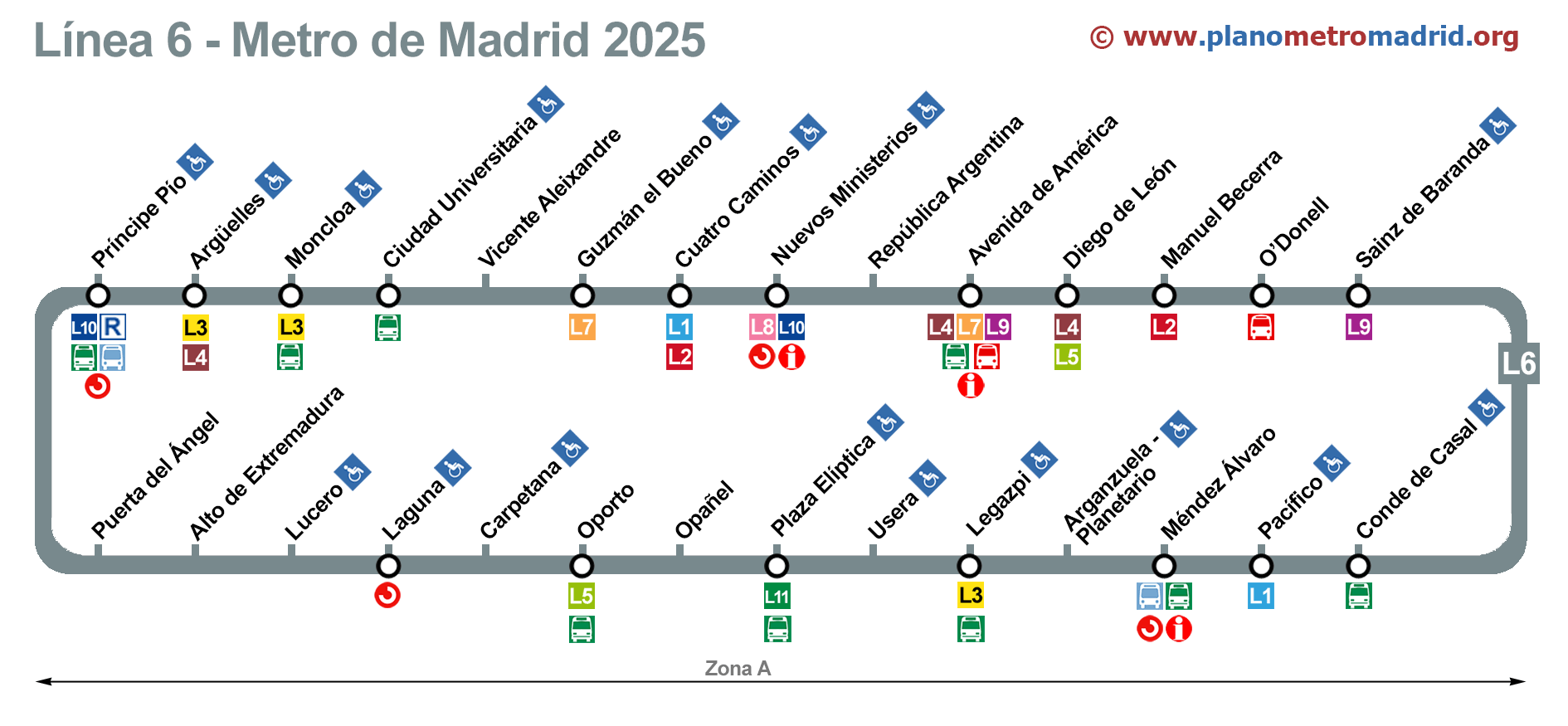
Line 6 Circular (28 stations):
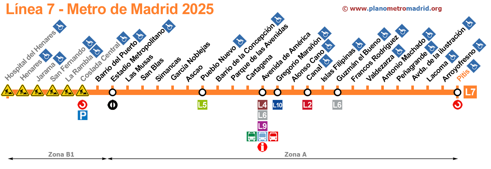
Line 7 (30 stations):
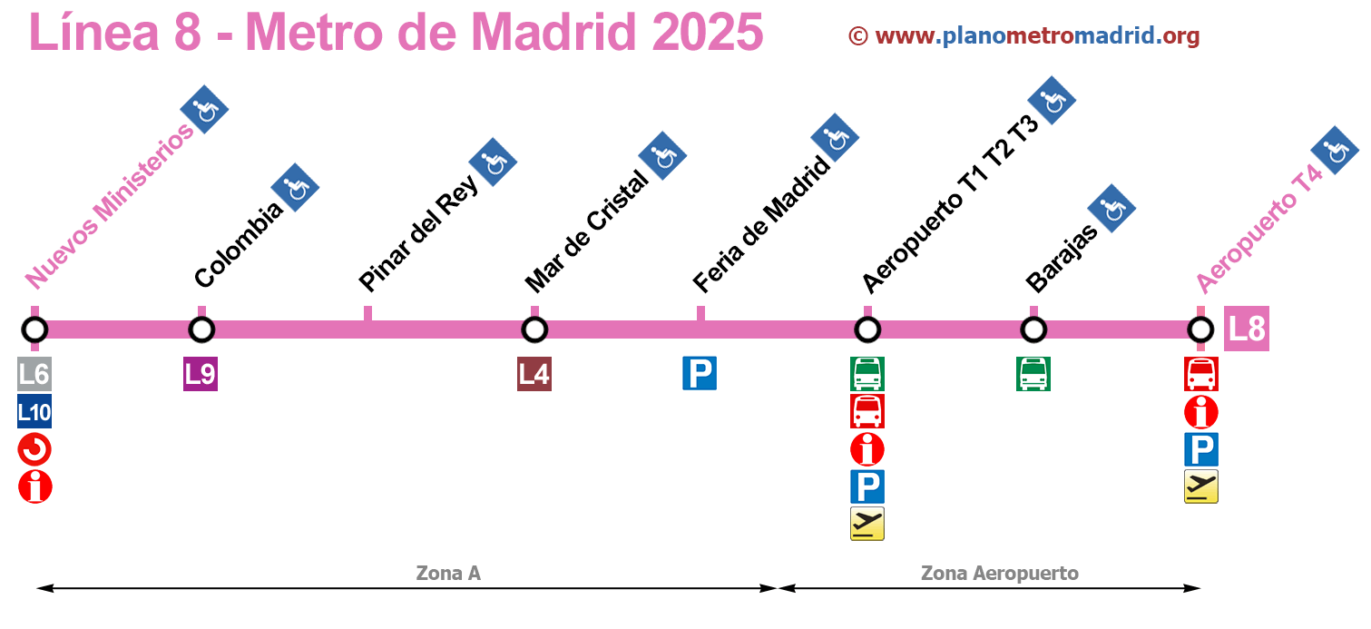
Line 8 (8 stations):
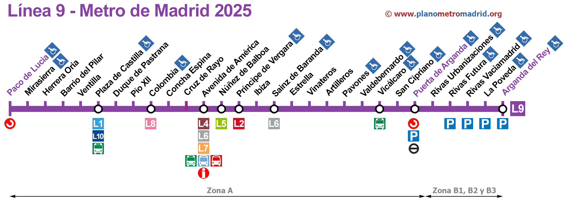
Line 9 (29 stations):
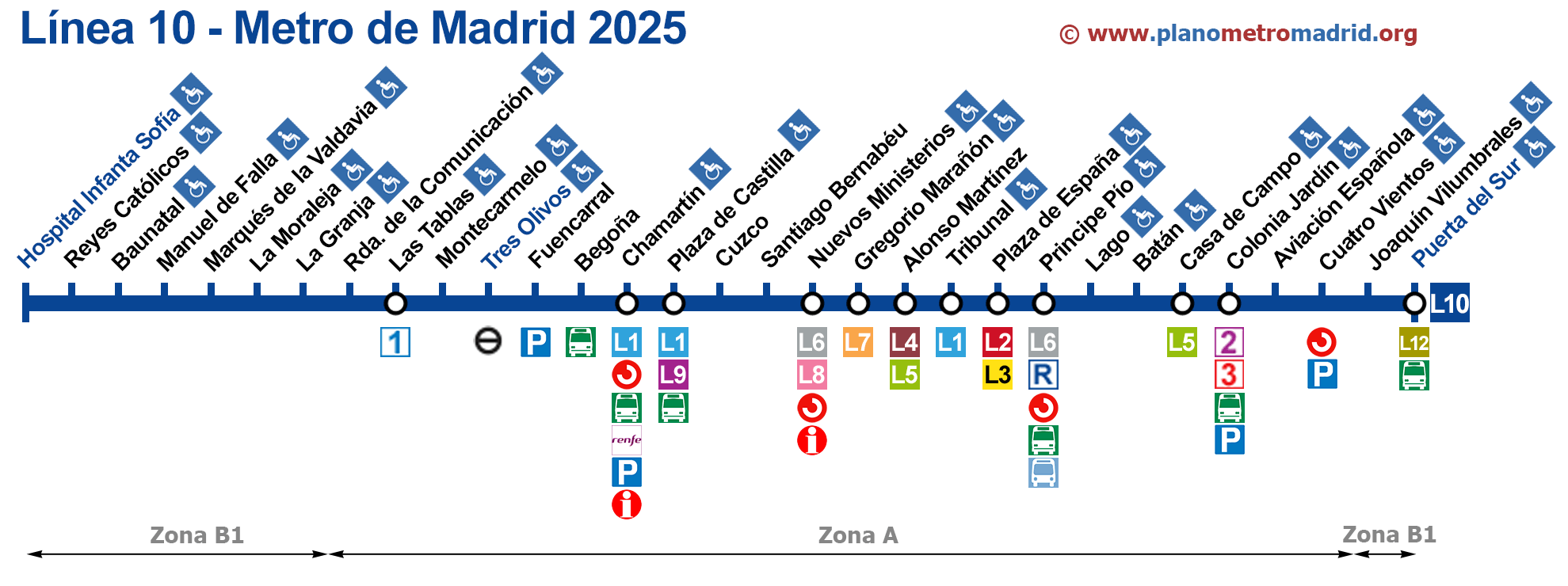
Line 10 (31 stations):
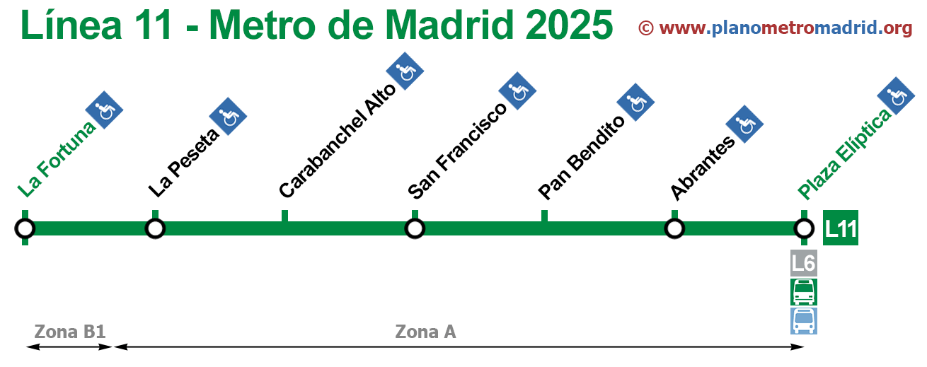
Line 11 (7 stations):
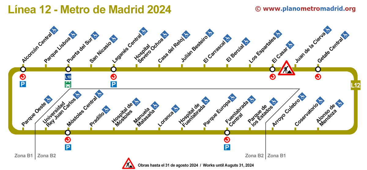
Line 12 (28 stations):
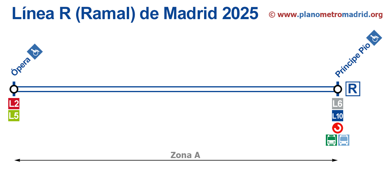
Line R (Ramal) (2 stations):
And that's all, We hope you found what you were looking for on our website..