The Munich Metro, officially known as “Münchner U-Bahn”, is the underground transportation system in the city of Munich, Germany.
Inaugurated on 19 October 1971, This system has gone through numerous expansions, with the last in 2010.
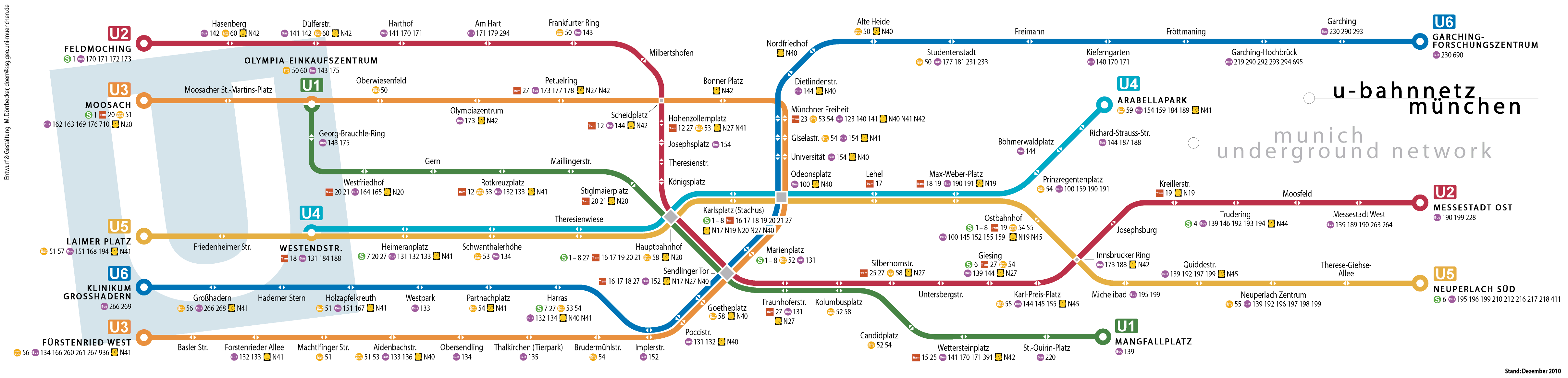
Currently it has 8 lines that cover 102 stations, covering a length of 103.1 kilometres (about 64.06 miles). It is crucial for the daily mobility of residents and tourists moving through the city.
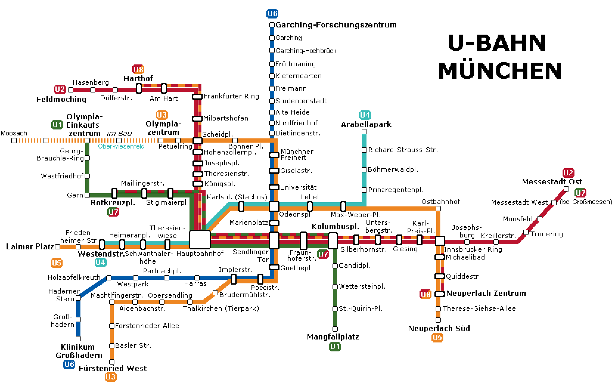
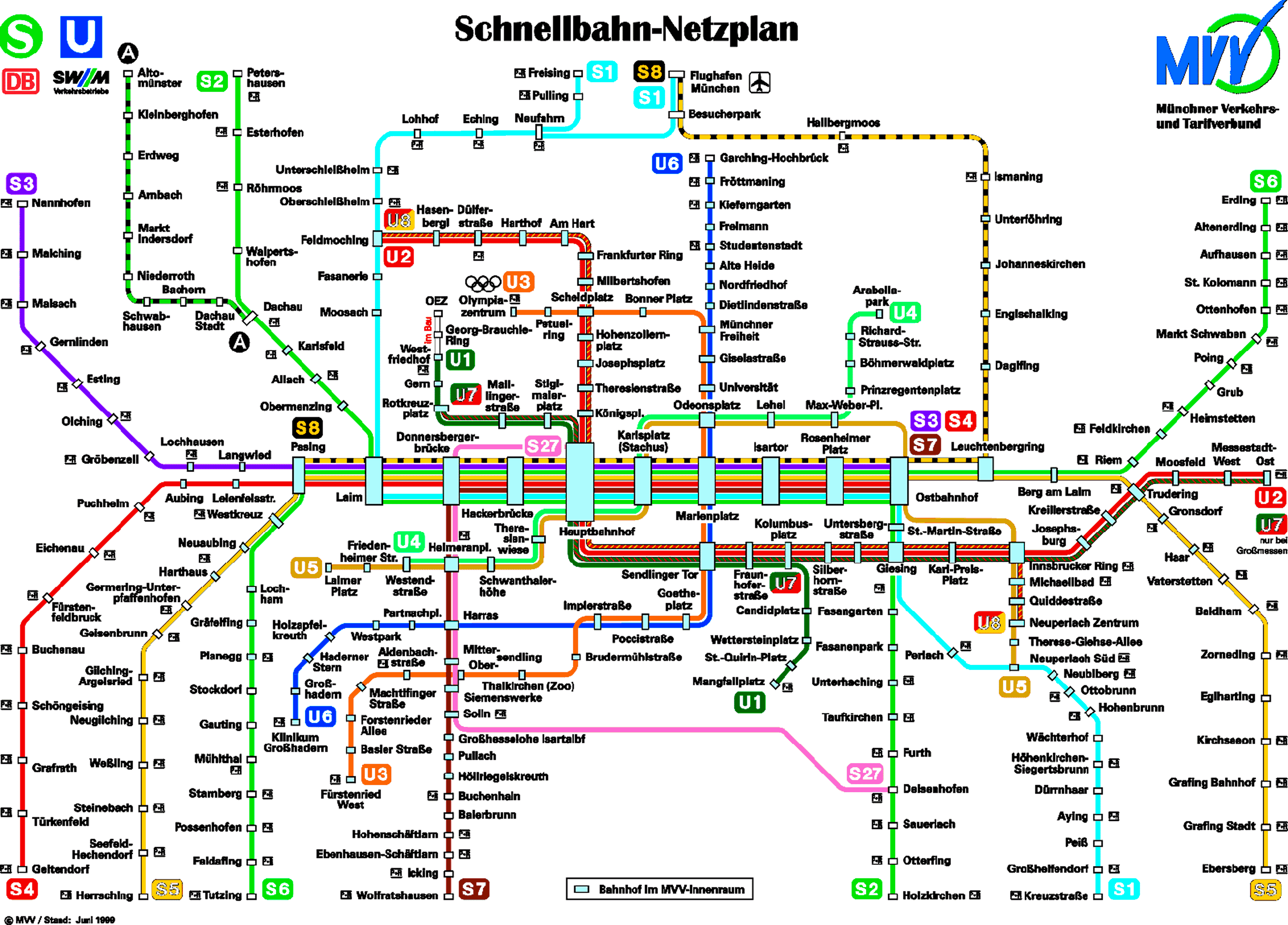
Here's the Munich Metro map:
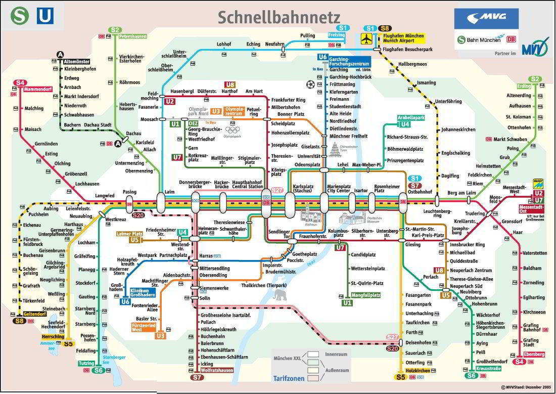
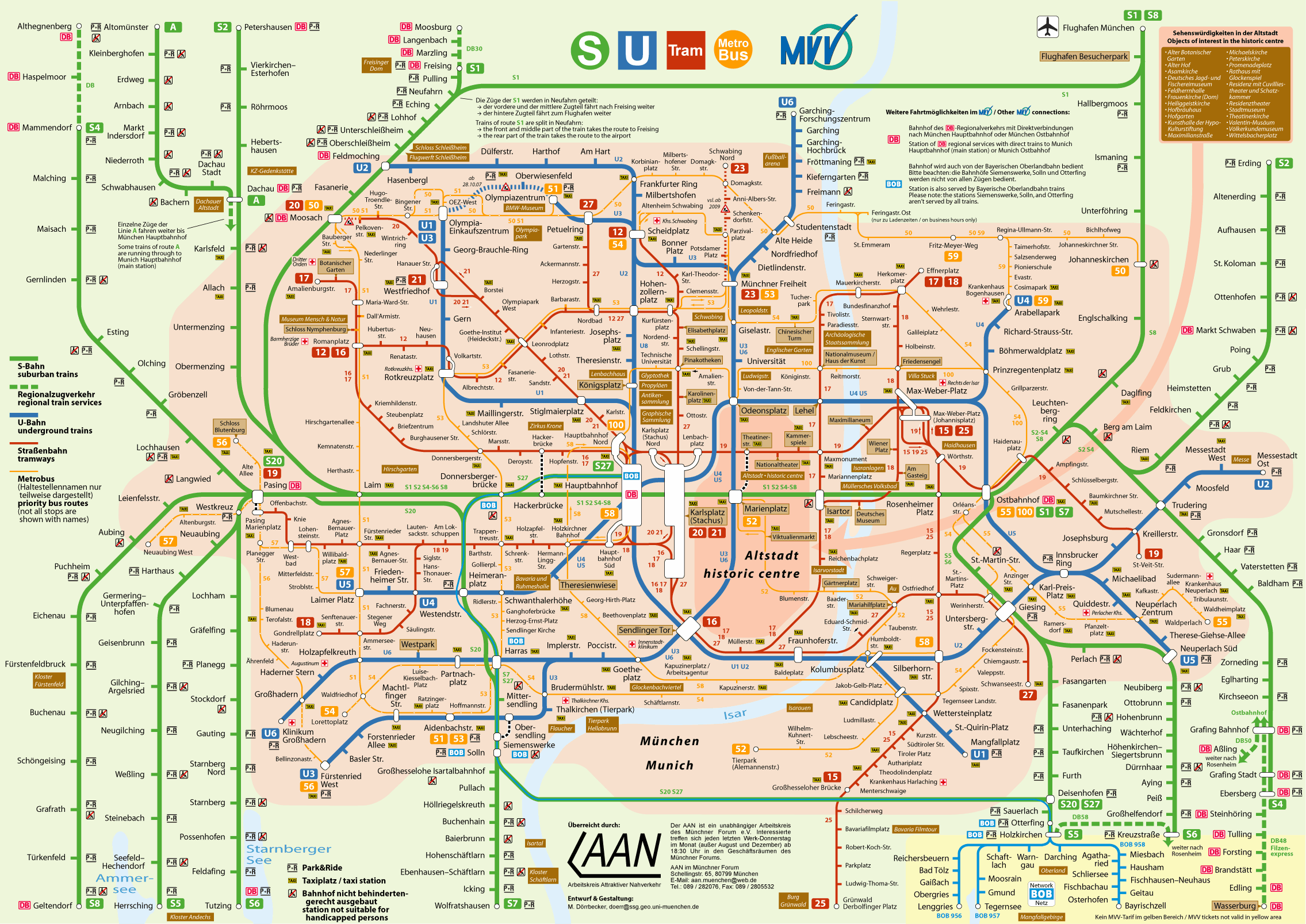
You can download the previous map in PDF version and in high resolution: Munich-metro-map-schnellbahnnetzplan.pdf. We continue with more maps:
Schedules
The Munich Metro operates with the following schedules:
- Every day: of 4:00h a 1:00h.
Rates
The system offers the following options:
| Type of ticket | Price in EUR (USD) | Details |
|---|---|---|
| One-way ticket | 3.30 EUR (~3.62 USD) | a single trip. |
| Individual Day Ticket | 8.80 EUR (~9.66 USD) | Unlimited trips for one day. |
| Party ticket | 16.10 EUR (~17.69 USD) | Until 5 people for a day. |
Official Web site
For more information, visit the official site of the Munich Metro.
To find a Complete list of tourist attractions in Munich, We recommend you visit the well-known page web de Tiqets. In addition to discovering options that you may not have known about, you can buy tickets in advance, avoiding queues, bad weather and, sometimes, get up to a 20% off.
History of the Metro
The Munich Metro was inaugurated on 19 October 1971, coinciding with the city's preparation for the Olympic Games 1972.
Conceived as a solution to meet the growing demand for urban transportation, The system initially consisted of only two lines, that connected the center with the peripheral areas.
Over time, the network expanded to connect a greater variety of areas and neighborhoods, and modern technology was incorporated. From automatic signaling systems to highly energy efficient trains, which has allowed us to significantly improve capacity and safety.
Hoy, The Munich Metro is a fundamental backbone of public transport in the city, with a network that continues to grow.
History of the Munich Metro Map
The history of the Munich subway map is intrinsically linked to its growth.
The original design, that reflected only the two founding lines (U1 and U6), It was developed by a local team of engineers and cartographers led by Horst Spörl.
As the network expanded, so did the map, introducing visual innovations to simplify the understanding of an increasingly complex system.
In the decade of 1980, The map was modernized under the direction of the Münchner Verkehrsgesellschaft (MVG), integrating not only metro routes, but also other forms of transport, like trams and buses, to offer passengers a complete view of mobility options in the city.
Additional data
The Munich Metro is not only an efficient means of transportation, but also offers direct access to many of the most emblematic points of the city. Here are some key stations next to nearby attractions:
- Marienplatz (U3, U6): It connects with the historic square that houses the New Town Hall and its famous carillon, as well as the Cathedral of Our Lady.
- Odeon Square (U4, U5): Offers easy access to the English Garden, one of the largest urban parks in the world, and to the Munich Residence.
- Fruit warning (U6): The closest stop to the Allianz Arena, Bayern Munich stadium.
- Nymphenburg (U1): For lovers of history and art, It is the most convenient station to visit Nymphenburg Palace, a majestic palace complex.
- Olympiazentrum (U3): Located near the Olympic Park and the BMW Museum, a fascinating experience for car enthusiasts.