Saltar al contenido
mapametro.com
Menu
América del Norte
América del Sur
Asia
Europa
Oceanía
Gran Bretaña
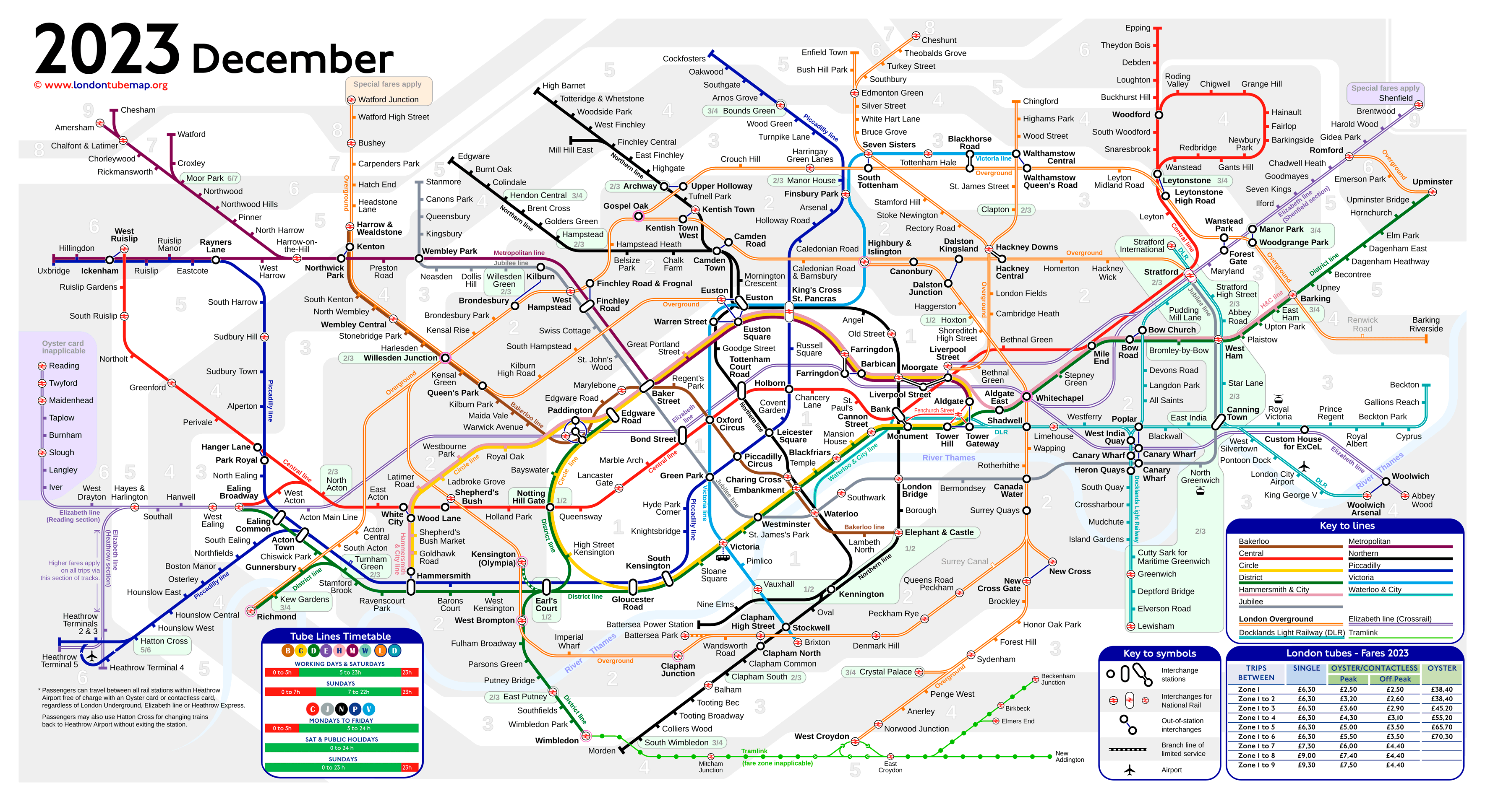
Mapa metro de Londres