![]() The Paris Metro (known as “Paris Metro”) is located in France.
The Paris Metro (known as “Paris Metro”) is located in France.
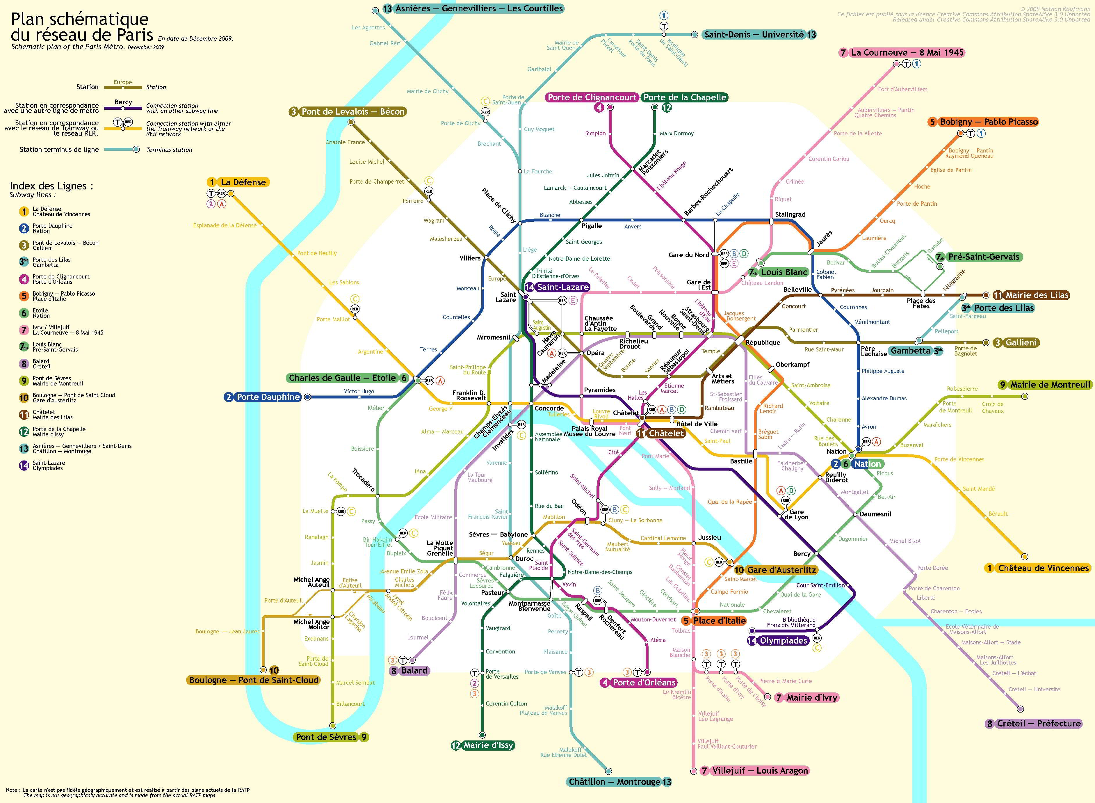
The last known extension of this meter was made in the year 2012, currently 382 Tube stations along 218,4 Km (135,7 miles), ie, each station has a 571,7 meters (625,2 yards).
The most up-to-date Paris metro map can be found on the website www.planmetroparis.net.
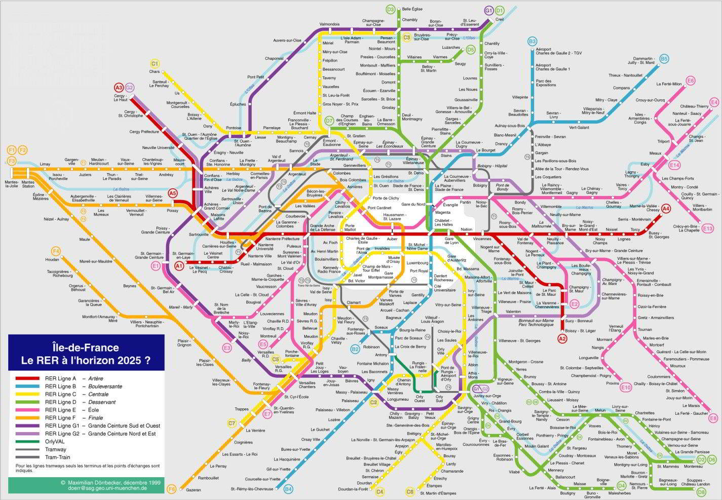
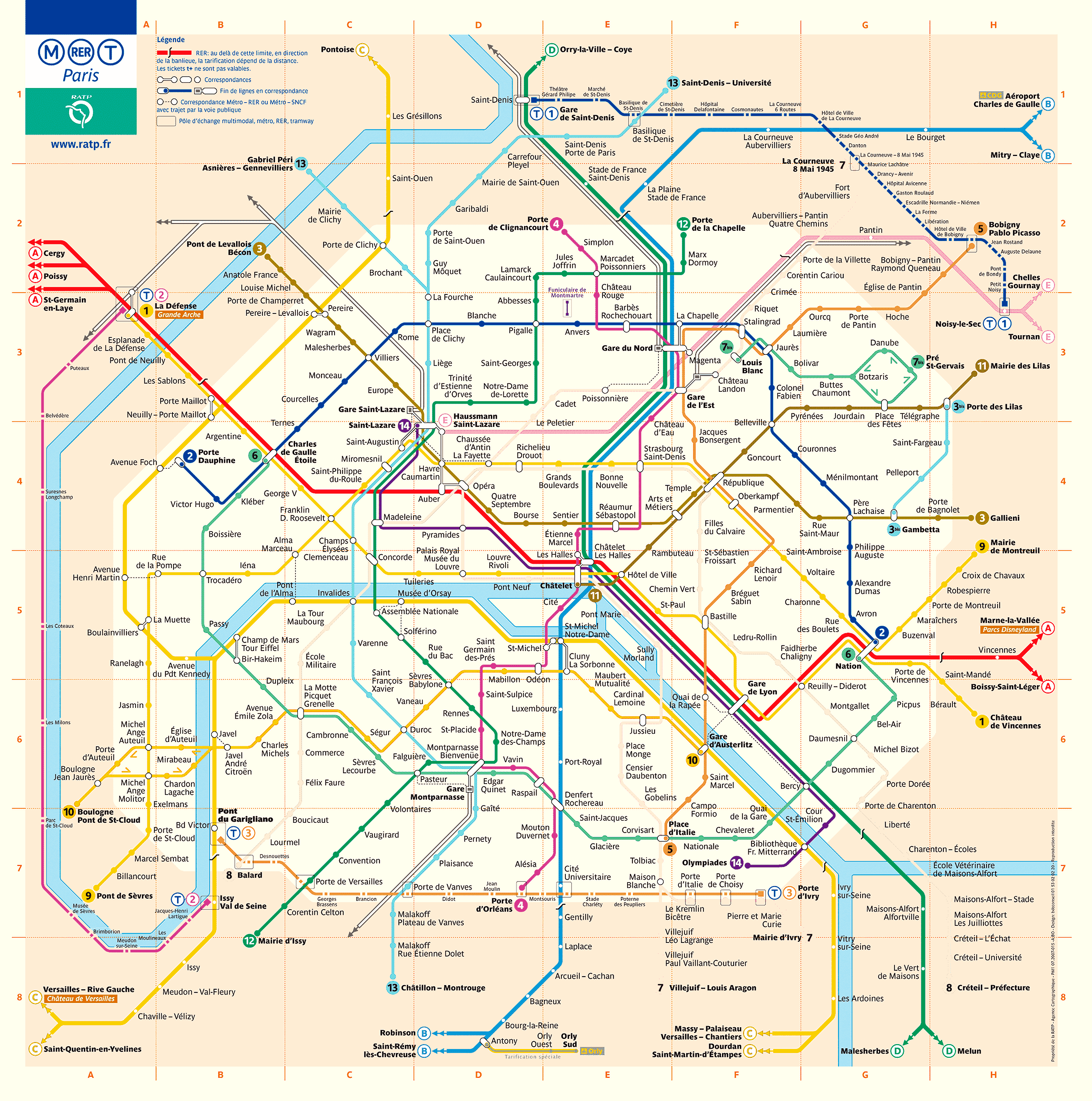
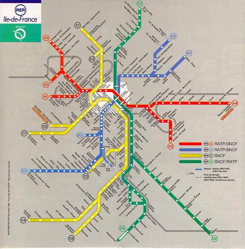
These maps below are a bit old, but if you want to see them, click above the map, to view larger image:
RECOMMENDATION: On the web TicketBar, You can save up to 20% in some bills as: Historic Paris and Notre Dame, Montmartre and the Louvre, River Cruise and Notre Dame, etc. Generally you can buy these tickets online and you save to queue.
Links:
We want a subway map in 3D