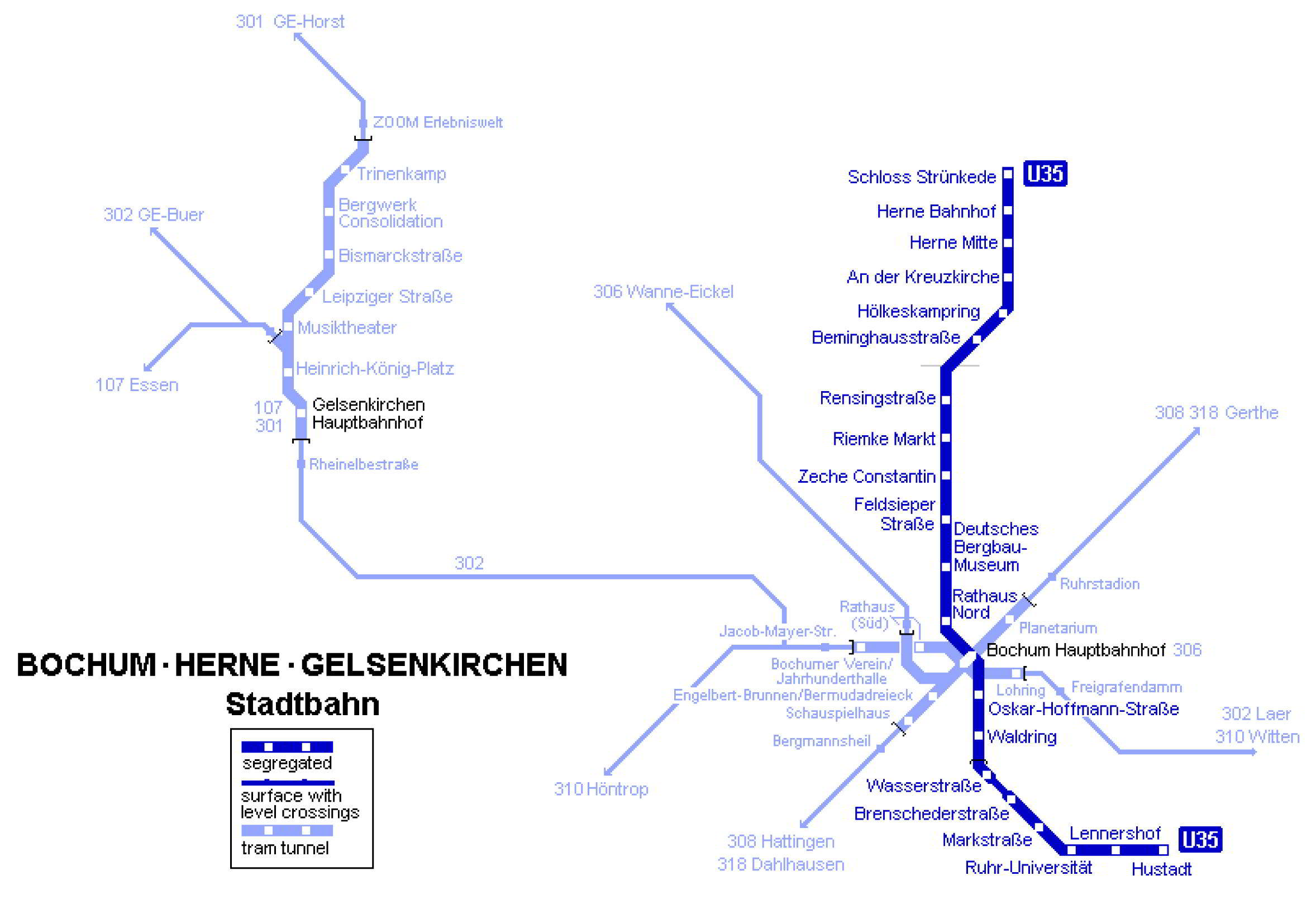
2 September, 2014
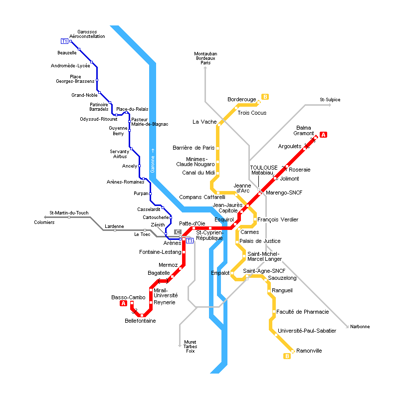
Toulouse metro map
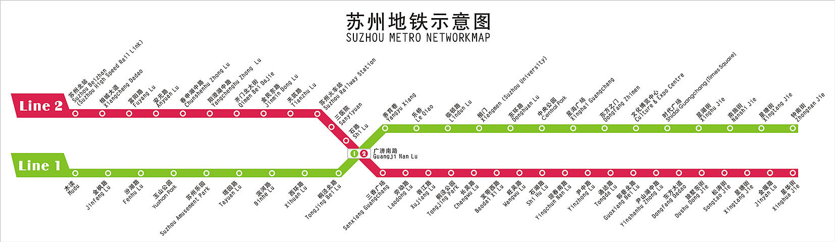
2 September, 2014
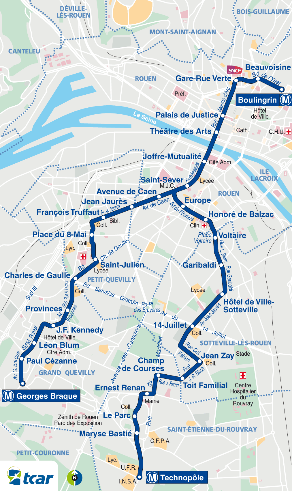
Ruan metro map
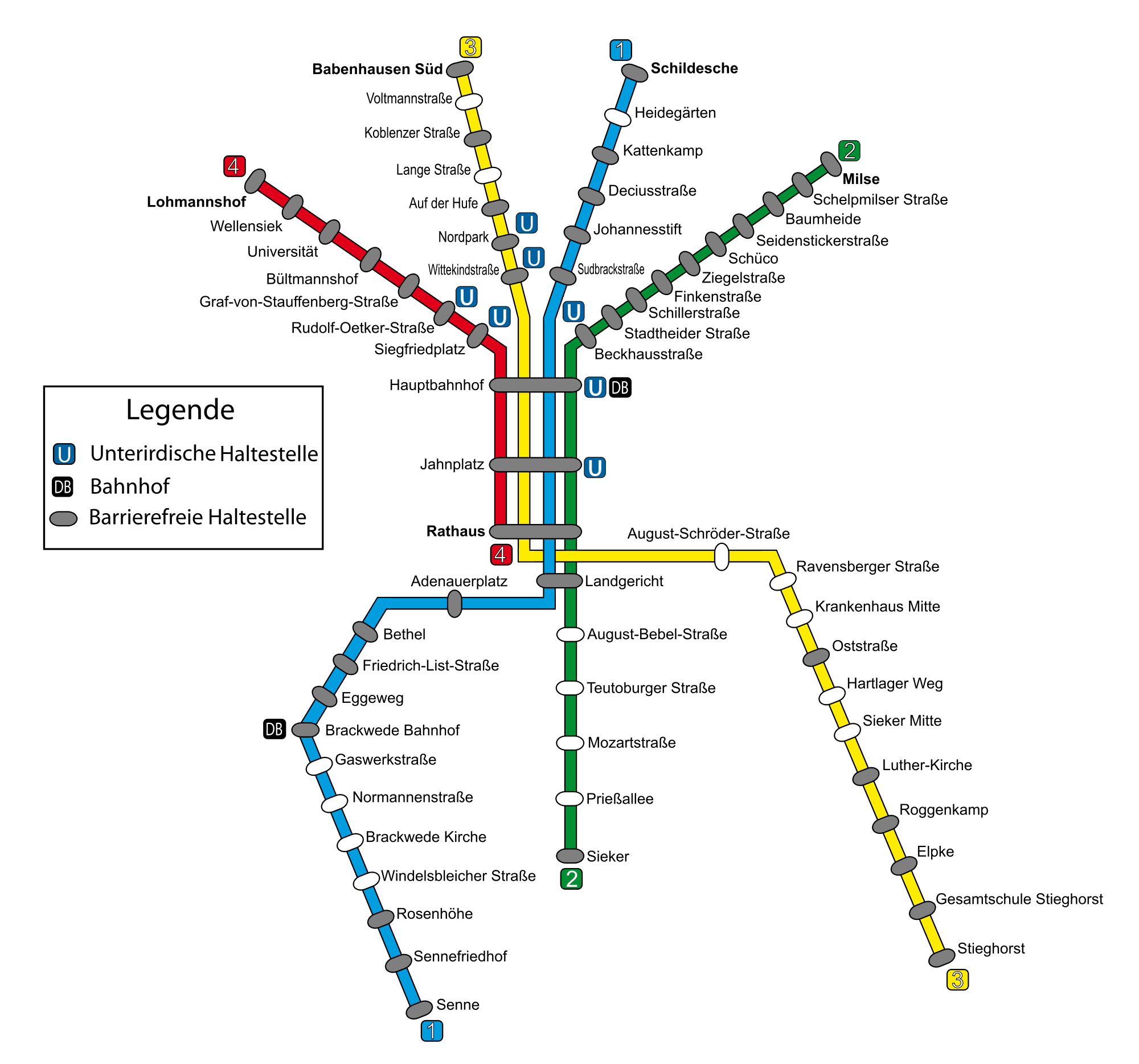
2 September, 2014
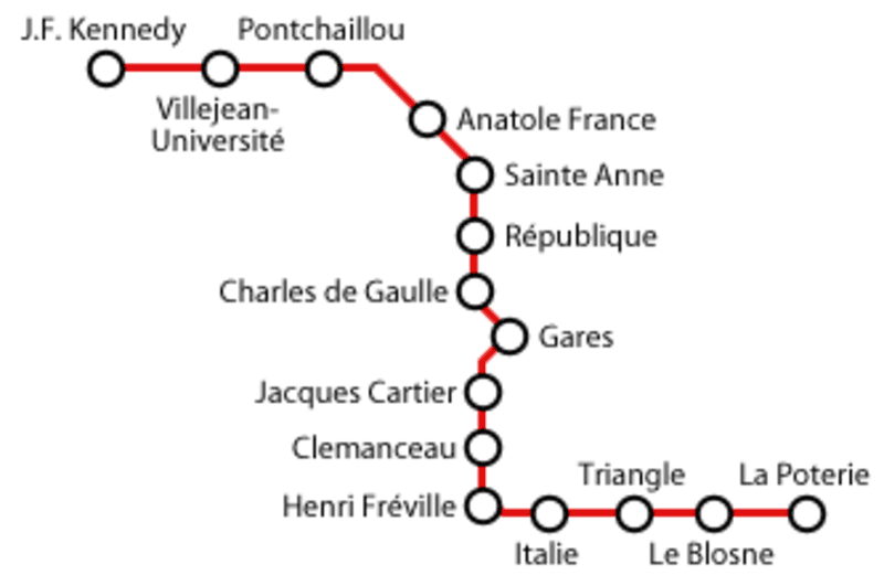
Rennes metro map
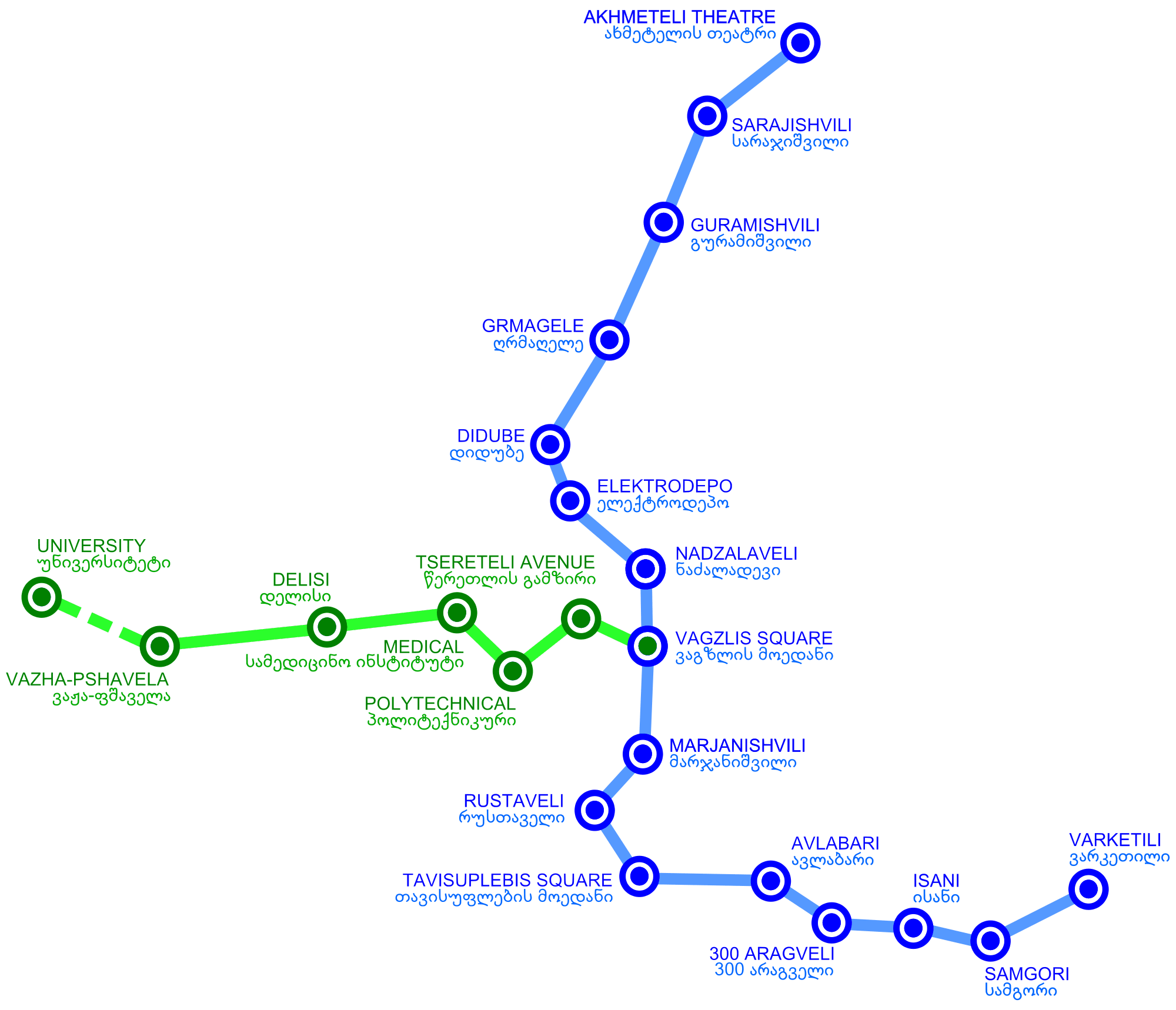
18 March, 2014
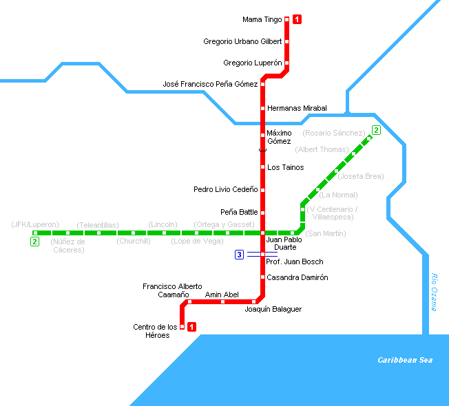
Subway map of Santo Domingo
7 March, 2014
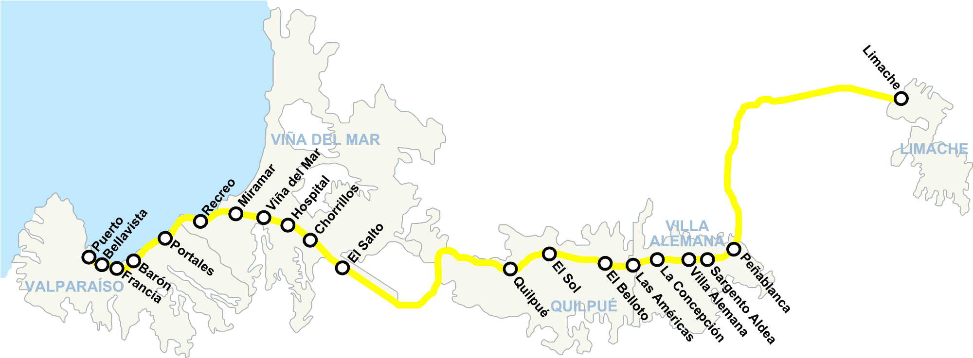
Metro Map of Valparaiso
6 March, 2014
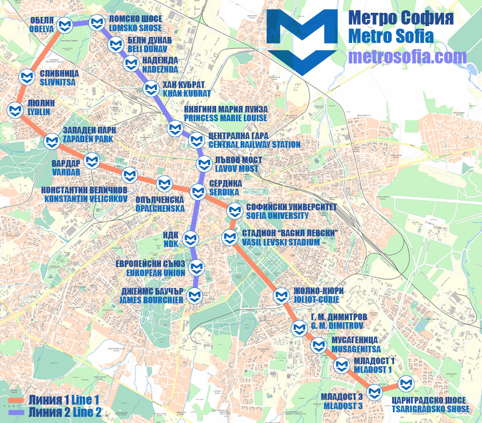
Map of Sofia Metro
6 March, 2014
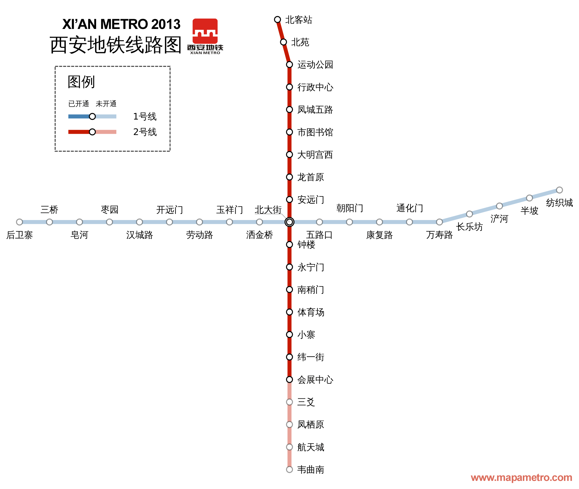
Xi'an metro map
6 March, 2014
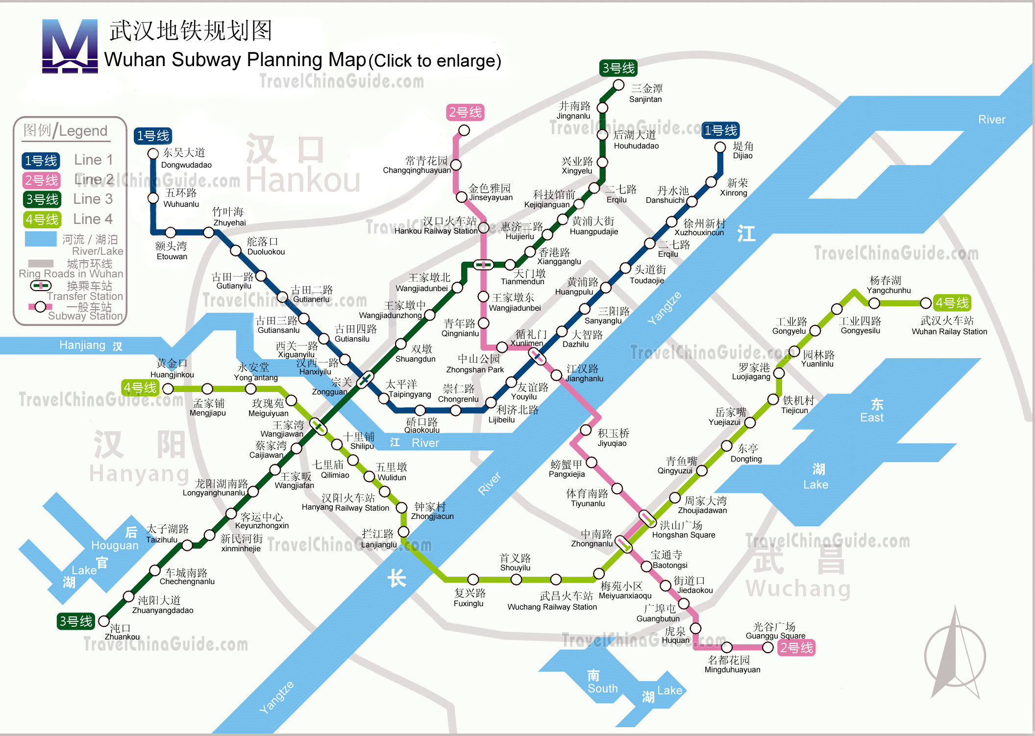
Wuhan Metro Map
6 March, 2014