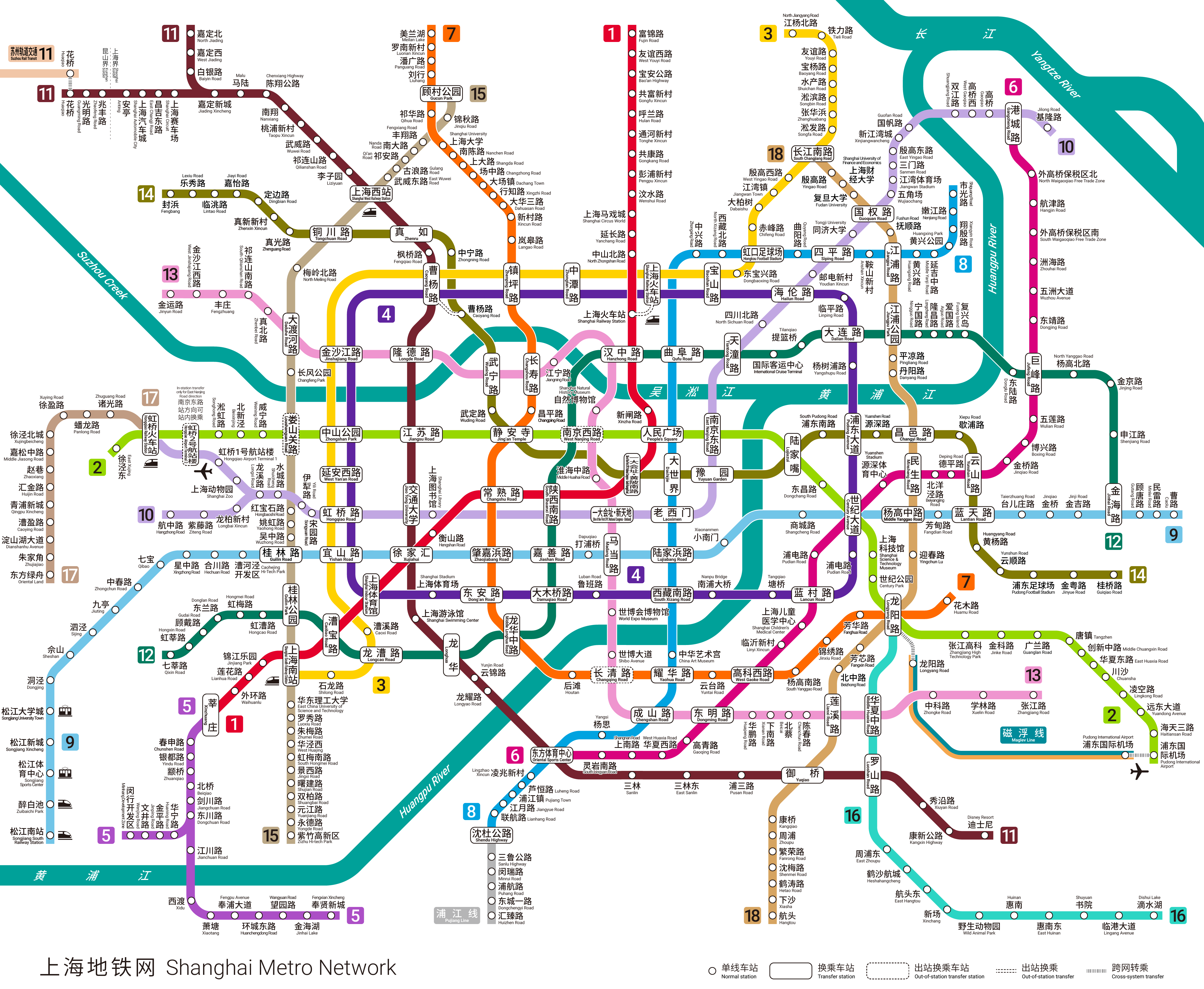
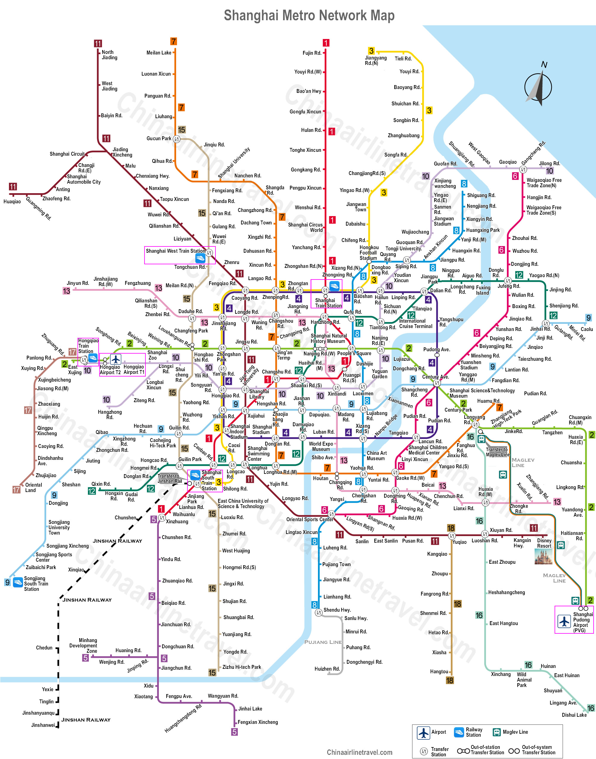
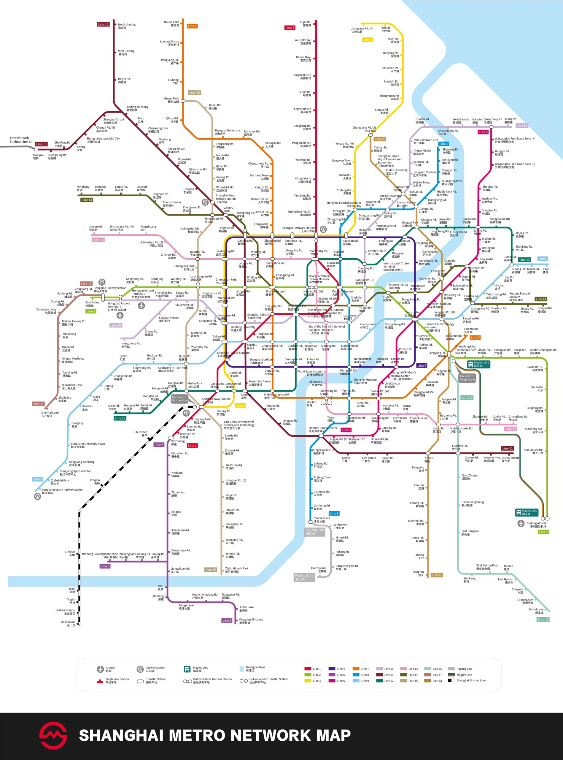
Shanghai subway, locally known as “上海地铁”, is a comprehensive transportation system serving the city of Shanghai, China.
Since its inauguration 10 April 1995, This metro has grown to become one of the longest in the world. Till the date, has 19 lines and an impressive total of 508 stations, spreading throughout 831 kilometres (516 miles) of roads.
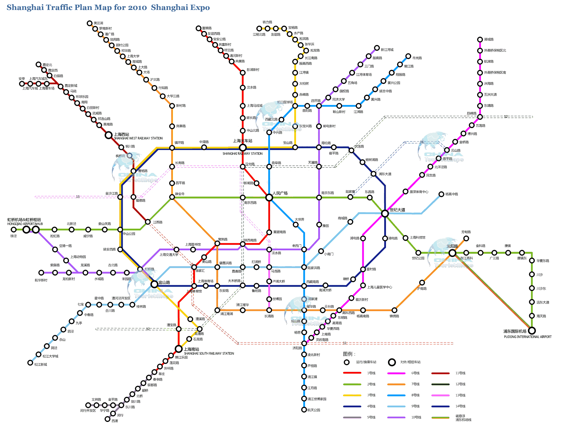
subway map
Below we show you several versions of the same Shanghai subway map:
Shanghai subway timetable
Shanghai Metro operates daily, including holidays, from the 6:00h until 23:30h.
Rates
The cost of a trip on the Shanghai metro varies between 3 y 10 CNY, depending on the distance traveled. This is approximately equivalent to 0.43 a 1.43 USD.
Official Web site
For more information, visit the Shanghai Metro official website.
History of the Shanghai Metro
The Shanghai Metro was inaugurated on 28 May 1995 with the opening of the Line 1 that connected the stations Jinjiang Park a Xinzhuang.
In 2000 The line was inaugurated 2 connecting the east and west of Shanghai. In 2000 the line was opened 3 and in 2005 the line 4, creating a central ring.
The most recent expansion in 2024 saw the inclusion of new stations and the extension of existing lines.
History of Shanghai Subway Map
The original subway map was created by the Shanghai government's urban planning team, in collaboration with local and international experts. In its early stages, The map design focused on functionality and simplicity, using distinctive colors for each line and ensuring that station names were easily legible.
The company Shanghai Shentong Metro Group has been instrumental in constantly monitoring and updating the map to reflect the expansion of the system.
One of the most significant revisions to the map was made in 2010, just before the Shanghai World Expo. This review, designer led Chen Jingyuan, incorporated international iconography and a more intense and saturated color scheme, thus improving readability for international users.
Additional data
The Shanghai metro facilitates the daily movement of millions of people and also serves to explore the most touristic spots in the city.
Next, Some of these points are highlighted with the corresponding metro station:
- The Bund (Station East Nanjing Road): Considered one of the most photographed places in Shanghai, The Bund is easily accessible from the station East Nanjing Road, located on the famous Line 2.
- Shanghai Tower (Lujiazui Station): The second tallest tower in the world can be visited by getting off at Lujiazui station. This area is a global financial center and a landmark on the Shanghai skyline.
- Shanghai Museum (People's Square Station): Located in the heart of the city, Shanghai Museum offers a rich collection of art and artifacts that chronicle China's cultural history.
- Templo Jing’an (Jing'an Temple Station): One of the most famous Buddhist temples in Shanghai, accessible directly from Jing'an Temple station on the Line 2 y 7.
- Xintiandi (Station South Huangpi Road): An entertainment area famous for its nightlife and combination of traditional and modern architecture, accessible from the station South Huangpi Road On the line 1.