![]() The Metro de Sao Paulo (officially is called as “Sao Paulo Metro”) is located in Brazil.
The Metro de Sao Paulo (officially is called as “Sao Paulo Metro”) is located in Brazil.
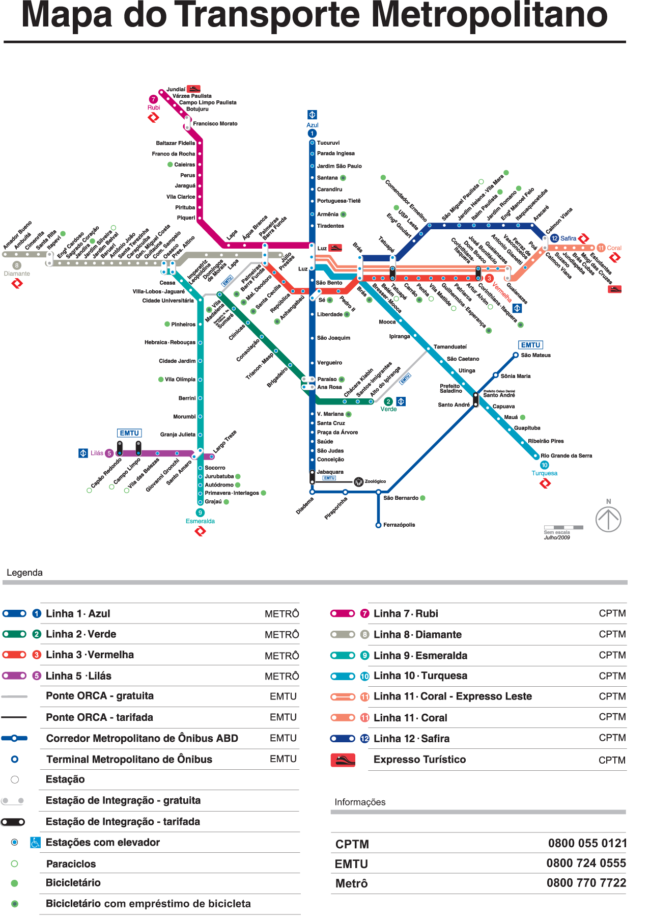
It was expanded last year 2011, currently 67 Tube stations along 74,3 Km (46,2 Miles), which is to have on average each station 1109 meters (1212,8 Yards).
Click on the map below Metro Sao Paulo to enlarge:
Related Links: